 NERC Data Catalogue Service
Uranium
Type of resources
Topics
Keywords
Contact for the resource
Provided by
Years
Formats
Representation types
Update frequencies
Scale
-

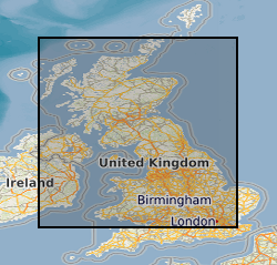
Two sediment depth cores were collected from the floor of Loch Etive, near Oban, Scotland. Slicing was performed in an anaerobic bag. Samples were taken at 0.5 cm increment between 0 - 2 cm, 1 cm increments between 2 - 10 cm, and at either 2 or 5 cm increments thereafter. Samples were transferred to Newcastle University for DNA extraction. A total of 21 samples were extracted for core 1, and 23 samples extracted for core 2.
-

Two sediment depth cores were collected from a mud sediment patch at the sea floor of the Irish Sea. Cores were collected by the University of Manchester. Cores were sliced at 1 cm intervals from 0 - 10 cm, and at 2 cm intervals thereafter. Slicing was performed in an anaerobic bag. Samples were transferred to Newcastle University for DNA extraction. A total of 21 samples were extracted for core 1, and 23 samples extracted for core 2.
-

Soil depth core collected from the Needle’s Eye site in Dumfries, Scotland. Clear plastic depth core was lowered into a bog within the site, excised, and capped at the top and bottom. Core was sliced at 1 cm intervals at the University of Manchester in an anaerobic bag. A total of 41 samples were generated. Soil samples were returned to Newcastle University.
-

Two sediment depth cores were collected from the River Esk estuary during low tide near the town of Ravenglass, UK. Cores were collected by the University of Manchester. Cores were sliced at 1 cm intervals from 0 - 10 cm, and at 2 cm intervals thereafter. Slicing was performed in an anaerobic bag. Samples were transferred to Newcastle University for DNA extraction. A total of 19 samples were extracted for core 1, and 18 samples extracted for core 2.
-

Activity (dpm/g) of Uranium and thorium isotopes from 3 sediment cores in the North Atlantic: ODP980, ODP983, EW9302-2JPC. Ocean Drilling Program (ODP) Site 980 was drilled in July 1995 in the North Atlantic Ocean, on the Feni Drift, off the eastern edge of the Rockall Plateau at 55.49°N, 14.70°W. Hole 980A Position: 55°29.087'N, 14°42.134'W. Hole 980B Position: 55°29.094'N, 14°42.137'W. ODP Site 983 was drilled was drilled in July 1995 and is located on the Bjorn Drift in approximately 1650 m water depth on the eastern flank of the Reykjanes Ridge. Hole 983A Position: 60°24.200'N, 23°38.437'W. Site EW9302-2JPC, an ODP Site Survey in 1993, of Rockall Plateau and East Flank of Reykjanes Ridge from the Flemish Cap in the south- eastern Labrador Sea (Figure 1). EW9302-2JPC Position: 4847.700 N, 4505.090 W, taken at water depth 1251m.
-
THIS DATASET HAS BEEN WITHDRAWN **This dataset was created for the "Britain beneath our feet" atlas using information extracted from the Geochemical Baseline Survey Of The Environment (G-BASE) For The UK . For Uranium in stream sediment data please see Geochemical Baseline Survey Of The Environment (G-BASE) For The UK ** Geochemical Baseline Survey Of The Environment (G-BASE) coverage for Uranium in stream sediment. The G-BASE programme involves systematic sampling and the determination of chemical elements in samples of stream sediment, stream water and, locally, soil, to build up a picture of the surface chemistry of the UK. The average sample density for stream sediments and water is about one site per 1.5-2km square. Analytical precision is high with strict quality control to ensure countrywide consistency. Results have been standardised to ensure seamless joins between geochemical sampling campaigns. The data provide baseline information on the natural abundances of elements, against which anomalous values due to such factors as mineralisation and industrial contamination may be compared.
-

Soil depth core collected from the Needle’s Eye site in Dumfries, Scotland. Clear plastic depth core was lowered into a bog within the site, excised, and capped at the top and bottom. Core was sliced at 1 cm intervals at the University of Manchester in an anaerobic bag. A total of 42 samples were generated. Soil samples were returned to Newcastle University.
-
Experimental results used to parameterise and a test a mathematical model of uranium diffusion and reaction in soil. The exeperiments and model are described in Darmovzalova J., Boghi A., Otten W., Eades, L., Roose T. & Kirk G.J.D. (2019) Uranium diffusion and time-dependent adsorption-desorption in soil: a model and experimental testing of the model. Eur. J. Soil Sci., doi: 10.1111/ejss.12814. The research was funded by NERC, Radioactive Waste Management Ltd and the Environment Agency through the Radioactivity and the Environment (RATE) programme (Grant Ref NE/L000288/1, Long-lived Radionuclides in the Surface Environment (LO-RISE)).
-
This spreadsheet contains (U-Th-Sm)/He data for 73 hematite samples from the supergene profile of the Spence porphyry copper deposit in the Central Andes. These data are discussed in the G-cubed publication titled 'A rusty record of weathering and groundwater movement in the hyperarid Central Andes' (Shaw et al., 2021). Spence porphyry copper deposit Drill hole SPD0324, UTM WGS1984 19S, E 474975.22, N 7481100.39 Drill hole SPD 1848, UTM WGS1984 19S, E 474998.29, N 7481399.87 Drill hole SPD 0402, UTM WGS1984 19S, E 473969.87, N 7479755.01
-

A worldwide compilation of 189 analyses of U and Pb concentrations in olivine-hosted melt inclusions from ocean island magmas. These data were used in Delavault et al. (2016, Geology 44, 819-822) to calculate the present-day distribution of the U/Pb ratios in magmas generated in intraplate setting.