 NERC Data Catalogue Service
Volcanoes
Type of resources
Topics
Keywords
Contact for the resource
Provided by
Years
Formats
Representation types
Update frequencies
-

Acoustic emissions (AE) and ultrasonic wave velocity data recorded during a series of high temperature thermal cracking experiments by Daoud et al., in the Rock and Ice Physics Laboratory of the University College London. The data gives the time and magnitude of AE output which were recorded contemporaneously whilst cyclically heating three rock types (A Slaufrudalur Granophyre, A Santorini Andesite and a Seljadalur Basalt). The ultrasonic wave velocity data was recorded pre- and post- heating. The data acquisition was permitted using a rock placed within an acoustic wave guide placed inside a high temperature furnace.
-

Whole rock analyses (presented in parts per million, ppm) of volcanic samples from Mt. St Helens, Washington, USA. Detailed sample descriptions and given in Blundy et al. (2008) and references therein. All samples were analysed using solution ICP-MS at the Open University. Blundy, J., Cashman, K.V. and Berlo, K. (2008) Evolving magma storage conditions beneath Mount St. Helens inferred from chemical variations in melt inclusions from the 1980-1986 and current (2004-2006) eruptions, in: Sherrod, D.R., Scott, W.E., Stauffer, P.H. (Eds.), A volcano rekindled: the renewed eruption of Mount St. Helens, 2004-2006, Reston, VA, pp. 755-790.
-
Whole-rock geochemistry data of samples collected from Tindfjallajökull volcano, south Iceland. For further information, see Moles, J. D. (2018). Volcanic archives of past glacial environments: Tindfjallajökull volcano, Iceland. PhD thesis, The Open University. http://oro.open.ac.uk/id/eprint/62117. Geographical extent: Bounding box latitude and longitude: SW corner 63°42'N 19°46'W and NE corner 63°50'N 19°28'W.
-
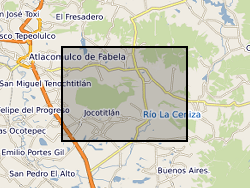
The data is provided as a single spreadsheet containing geochemical information from three volcanoes (Antuco, Chile; Jocotitlan, Mexico; Montserrat), all of which have been affected by major debris avalanches. The data was collected in order to investigate the long-term evolution of these volcanic systems. In addition, a single worksheet is provided of a summary database of published examples of volcanic debris avalanches. The geochemical data include bulk-rock XRF and ICP-MS data, Sr and Pb isotope measurements, and glass analyses for the Montserrat samples, along with site information for Antuco and Jocotitlan. Additional published analyses for Montserrat is availabile in published papers, as detailed in the spreadsheet.
-

The data are associated with a paper entitled 'Widespread tephra dispersal and ignimbrite emplacement from a subglacial volcano (Torfajökull, Iceland)' by J Moles et al. (2019). See paper for full details. Data types: major element geochemistry; trace element geochemistry; 40Ar/39Ar geochronology. Table DR9 contains EPMA data of proximal lavas and ignimbrite fiamme. Table DR10 contains EPMA data of ash shards. Table DR11 contains EPMA standard data. Table DR12 contains LA-ICP-MS data of proximal lavas and ignimbrite fiamme. Table DR13 contains LA-ICP-MS data of ash shards. Table DR14 contains LA-ICP-MS standard data (raw). Table DR15 contains LA-ICP-MS standard data (corrected). Table DR16 contains 40Ar/39Ar geochronology data.
-
RINEX files of GPS observations obtained in the Uturuncu volcano and surroundings (Altiplano-Puna Deformation Anomaly) during the November 2018 and November 2022 campaigns. In the 2018 and 2022 campaigns, 8 and 10 GPS stations have been installed respectively to help constrain the temporal deformation at Uturuncu volcano. The data contains the GNSS observations made in the 2018 campaign at the stations of Depeche Mode (DEMO), Foo Fighters (FOOF), Jimmy (JIMY), Led Zeppelin (LDZP), Metallica (MTLC), Sex Pistols (SEXP), UBQ4 and UTU Base (UBAS) In the 2022 campaign at the stations of Depeche Mode (DEMO), Foo Fighters (FOOF), IGGY, Jimmy (JIMY), Led Zeppelin (LDZP), Metallica (MTLC), Nirvana (NRVN), Offspring (OFSP), Sex Pistols (SEXP) and UTU Base (UBAS) The following devices were used to obtain these data: -Receiver Leica GR30 (serial numbers 1705008, 1705617 and 1705619) -Antenna Leica AS10 (serial numbers 16071044 and 16151018) -Integrate antenna + receiver Topcon Hiper Pro (serial numbers 326-1106 and 342-0370) -Masts "Nysiros style" and UNAVCO single pin + masts. The duration of data collection ranges from 1 day to 6 days depending on the site of the collection.
-
Laser ablation (LA) ICP-MS analyses (presented in parts per million, ppm) of melt inclusions from the 1980 eruption of Mt. St. Helens (18th May-16th October). Detailed sample collection methods are given in Blundy et al. (2008). Blundy, J., Cashman, K.V. and Berlo, K. (2008) Evolving magma storage conditions beneath Mount St. Helens inferred from chemical variations in melt inclusions from the 1980-1986 and current (2004-2006) eruptions, in: Sherrod, D.R., Scott, W.E., Stauffer, P.H. (Eds.), A volcano rekindled: the renewed eruption of Mount St. Helens, 2004-2006, Reston, VA, pp. 755-790.
-
Data output from the numerical flow modelling in GRL manuscript ""Evidence for the top-down control of lava domes on magma ascent dynamics"", by Marsden, L., Neuberg, J. & Thomas, M., all of University of Leeds. The models were created using the Laminar Flow module in COMSOL Multiphysics v5.4 by L. Marsden. The following files are uploaded: Archive_Reference_Model.txt (Reference flow model: Gas loss function, Initial H2O content = 4.5 wt.% Excess pressure at depth = 10 MPa, Constant corresponding to crystal growth rate = 4e-6 s^-1 ) Archive_High_H2O.txt (Gas loss function, Initial H2O content = 10 wt.% Excess pressure at depth = 10 MPa, Constant corresponding to crystal growth rate = 4e-6 s^-1) Archive_No_Gas_Loss.txt (No gas loss, Initial H2O content = 4.5 wt.% Excess pressure at depth = 10 MPa, Constant corresponding to crystal growth rate = 4e-6 s^-1) Archive_Gamma_Low.txt (Gas loss function, Initial H2O content = 4.5 wt.% Excess pressure at depth = 10 MPa, Constant corresponding to crystal growth rate = 1e-6 s^-1) Archive_Excess_Pressure_0MPa.txt (Gas loss function, Initial H2O content = 4.5 wt.% Excess pressure at depth = 0 MPa, Constant corresponding to crystal growth rate = 4e-6 s^-1) Archive_Excess_Pressure_20MPa.txt (Gas loss function, Initial H2O content = 4.5 wt.% Excess pressure at depth = 20 MPa, Constant corresponding to crystal growth rate = 4e-6 s^-1) The files uploaded include the reference flow model and where a single key parameter has been changed in the flow modelling. We include data where the key parameter is at the upper or lower limit of the values tested. Data are not included where magma ascent is modelled to stall without the extrusion of a lava dome, as a time dependent model is not run in this case. A solution is provided using equilibrium modelling only. The following variables are output, at conduit centre unless specified: Depth (m), Time(s), Ascent velocity (m/s), Bulk Viscosity (Pa s), Crystal Content, Dome height (m), Gas Volume Fraction, Overpressure (Pa), Shear Stress at Conduit Wall (Pa)
-
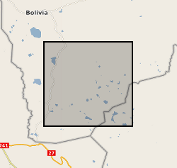
Microgravity data collected at Uturuncu Volcano located in the Altiplano-Puna Volcanic Complex, central Andes, in November 2022. Raw data collected along a survey line spanning from Laguna Colorada to Laguna Verde using a field gravimeter. All data have been preprocessed and corrected for tidal and drift effects. Data are reported with respect to reference station UBAS located to the west of Uturuncu near the Laguna Colorada.
-

The data report new F, Cl, and Br fluid/melt partition coefficients for intermediate to silicic melts, for which F and Br data are particularly lacking; and for varying CO2-H2O contents. The data was collected from basaltic andesite and dacite rock experiments from the Kelud volcano in Indonesia and Quizapu volcano in Chile Over the period of two years, 2020 – 2022. The experiments were conducted at pressures 50–120 MPa, temperatures 800–1100 °C, and volatile compositions [molar XH2O = H2O/(H2O +CO2)] of 0.55 to 1, with redox conditions around the Nickel-Nickel Oxygen buffer (ƒO2 ≈ NNO). Experiments were not doped with Cl, Br, or F and were conducted on natural crystal-bearing volcanic products at conditions close to their respective pre-eruptive state. The data was collected to assess the effects of changing fluid composition (XH2O) on Br fluid/melt partitioning for the first time. Three tables of data are provided; Table 1.xlsx Table 1 Experimental conditions, which were conducted under NNO oxygen buffer. Table 3.xlsx Table 3: Major element and Br, Cl and F contents of experiments, modelled water and CO2 values and Fluid/melt partitioning. The standard deviation (1 sigma) of the multiple analyses for each experiment (n=11-24) Table S2 SIMS and EMPA Secondary standards.xlsx SIMS and EMPA secondary standards Associated paper; Mike Cassidy, Alexander A. Iveson, Madeleine C.S. Humphreys, Tamsin A. Mather, Christoph Helo, Jonathan M. Castro, Philipp Ruprecht, David M. Pyle, EIMF; Experimentally derived F, Cl, and Br fluid/melt partitioning of intermediate to silicic melts in shallow magmatic systems. American Mineralogist 2022;; 107 (10): 1825–1839. doi: https://doi.org/10.2138/am-2022-8109