Water
Type of resources
Topics
Keywords
Contact for the resource
Provided by
Years
Formats
Representation types
Update frequencies
Scale
-
Data are distances (in cm) to water measured by an experimental near-infrared lidar sensor in six different setups (2017–9). Laboratory tests conducted at Imperial College London include quantifying the effect of (i) distance, (ii) sensor inclination, (iii) turbidity/clarity of the water, and (iv) ambient temperature on measurement bias. Outdoor tests at three locations in London interrogated the effect of varying water surface roughness on the measurements. A dataset of high-frequency measurements is also included, from which the effects of sample autocorrelation were interrogated.
-
This deposit consists of a readme file, which describes the file 'simulationinput.in'. This is a simple text file that contains the information necessary to run any of the ab initio molecular dynamics computer simulations described in the paper that links to this deposit, using the CP2K software package. CP2K is open source. Paper in press: Mineral–water reactions in Earth’s mantle: predictions from Born theory and ab initio molecular dynamics, Fowler, S. J. and Sherman, D. M. and Brodholt, J. P. and Sherman, D. M. Geochimica et Cosmochimica Acta.
-
Ethiopia experienced severe drought in 2015-16. Many rural communities experienced declines in the performance of their water supply systems. As a result UNICEF commissioned a real-time monitoring and responsive operation and maintenance programme for point source rural water supplies across Central, Northern and Eastern Ethiopia. The water point monitoring survey was coordinated by UNICEF and conducted by World Vision Ethiopia and Oxfam Ethiopia. Data was collected between January and May 2016. Akvo Flow, a mobile survey tool, was used to collect data using questionnaires which were completed by enumerators and uploaded to central servers in near real time. The dataset includes data on functionality, access, usage and water quantity from 5196 rural water points. UNICEF provided the dataset to BGS. BGS reorganised, cleaned, and conducted quality control and analysis of the dataset. A companion paper has been published with more details of the methodology and results of the monitoring survey, https://doi.org/10.1038/s41467-020-14839-3
-
Gro for GooD Rainfall Data from 22 Manual Rain Gauges, Kwale County, Kenya (NERC grant NE/M008894/1)
The dataset consist of daily rainfall data for 22 manual rain gauge stations installed by Gro for GooD project within and about the study area. The installed stations covering four river catchments name Ramisi River, Mukurumudzi River, Mtawa River and Mwachema River in Kwale County. The dataset period is from January 2016 to September 2017. Gro for GooD: Groundwater Risk Management for Growth and Development
-
Global Observatory of Lake Responses to Environmental Change (GloboLakes) was a project funded by the Natural Environment Research Council (NERC) with the following grant references: NE/J023345/2, NE/J02211X/1, NE/J023396/1, NE/J021717/1 and NE/J022810/1. This dataset contains the GloboLakes LSWT v4.0 of daily observations of Lake Surface Water Temperature (LSWT), its uncertainty and quality levels. The LSWTs are obtained by combining the orbit data from the AVHRR (Advanced Very High Resolution Radiometer) on MetOpA, AATSR (Advanced Along Track Scanning Radiometer) on Envisat and ATSR-2 (Along Track Scanning Radiometer) on ERS-2 (European Remote Sensing Satellite). The temperatures from the different instruments have been derived with the same algorithm and harmonised to insure consistency for the period 1995-2016. The GloboLakes LSWT v4.0 was produced by the University of Reading in 2018 for long term observations of surface water temperature for about 1000 lakes globally. The dataset consist of two sets of files: 1) a single file per day on a 0.05° regular latitude- longitude grid covering the period from June 1995 to December 2016 (folder = daily), 2) a file per lake which contains the time series (daily) of the lake on a 0.05° regular grid (folder = per-lake). The list of the GloboLakes lakes is included as a CSV file and it contains name, GLWD identifier, coordinate of the lake centre and a set of coordinates that can be used to locate the lake in the daily-file dataset. The LSWTs consists of the daily observations of the temperature of the water (skin temperature). Uncertainty estimates and quality levels are provided for each value.
-
The data are transcripts of qualitative community surveys carried out in Amuria (A) and Katakwi (K) districts, north-eastern Uganda, as part of a pilot project looking at causes of borehole/hand pump failure in rural areas. The community survey was designed to collected basic information on community water use, reconstruct the history of the water point and explore the socio-institutional factors that may have contributed to non-functionality. Key topics included: community engagement in planning and construction of the water point, access to the water point (and alternative water sources), water quality and yield (including seasonality), mechanical failures and repairs, water point management and by-laws, and fees and finances. The survey took the form of a semi-structured group discussion, guided by a set of questions covering the key topics. Each survey took 2-3 hours. Surveys were conducted for 24 water points. Participants included both water users and Water Point Committee (WPC) members. There were no restrictions on who from the community could participate in the discussion, hence numbers varied. The focus groups were facilitated by local NGO staff familiar with the districts, and guided by researchers from the Overseas Development Institute. The transcripts were produced from the detailed handwritten notes taken by the researchers during the group discussions, with the support of translators. The community surveys should be viewed as complementary to the technical investigations conducted at the borehole.
-
Programme of research funded by the Natural Environment Research Council. URGENT aims to stimulate the regeneration of the urban environment through understanding and managing the interaction of natural and man-made processes. Projects throughout the UK first set up in 1997 and completed in 2005. It was supported by partners from British industry, local authorities and Government agencies. A total of 40 URGENT projects in four key areas - air, water, soil and ecology. The projects aim was to determine the magnitude of urban environmental problems and risks, to understand the underlying patterns and processes that affect them, and to produce effective strategies for control and managment which will be accessible to users both in the UK and abroad.
-
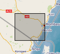
Results of microbial water quality conducted in Kwale County, Kenya from 2015 to 2017 by University of Oxford and Universitat Politecnica de Catalunya as part of the Gro for GooD project (https://upgro.org/consortium/gro-for-good/). Water samples from 101 locations (including 31 open wells, 27 deep boreholes, 21 shallow boreholes with handpumps, 15 covered dug wells with handpumps, and 10 surface water sites. This data set contains results for microbial risk parameters including Escherichia coli, thermotolerant coliforms (TTCs) and tryptophan-like fluorescence (TLF). Most samples also have accompanying data on pH, conductivity, water temperature and turbidity. Duplicate and replicate samples are included and indicated by 'Dup' or 'Rep'. Duplicates samples were collected from the same water points within minutes of each other and laboratory replicates were different aliquots from a single sample. Risk classifications of E. coli and TTC data are based on the World Health Organisation's microbial water quality risk grading scheme. Manufacturer recommended sampling protocols were used. The sampled water points were in regular use and boreholes were flushed with either an electric pump or hand-pumping prior to sample collection. Samples from the open wells were drawn with buckets and rope, which were designated for each site and were rinsed prior to sampling to minimise secondary contamination. Daily field and laboratory blank samples were analysed to confirm no secondary contamination or cross-contamination between sites. For the tryptophan-like fluorescence (TLF) measurement, approximately three litres of unfiltered water were pumped or poured into a stainless-steel container (kept in a black box to prevent ambient light from interfering). The container was cleaned with ethanol and triple-rinsed with sample water prior to each measurement. Measurement was conducted for approximately 3 minutes and the median result was used. The probe and its sensor window were kept clean. Air bubble formation on the sensor window was avoided. For the bacteria sampling, sterile purpose-made bags were used for sample collection and immediately stored in a cooler box with ice-packs. They were transported and processed to begin incubation within two to five hours. Gro for GooD: Groundwater Risk Management for Growth and Development
-
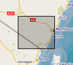
The file contain groundwater level/depth (WL), Groundwater and Surface Water Quality data (EC (micro-siemens per centimetre or µS/cm), Temperature (°C) and pH) for 49 points under fortnightly monitoring relevant to Gro for GooD research project in Kwale County, Kenya. Blank - Data not available. Gro for GooD: Groundwater Risk Management for Growth and Development
-
Data files and reports from NERC grant NE/L001934/1, Optimizing Road Development for Groundwater Recharge and Retention. 1. Optimizing Intensified Runoff from Roads for Supplemental Irrigation: Tigray Region, Ethiopia MSc Thesis by Meseret Dawit Teweldebrihan 2. Reconnaisance Report: Potentials of water harvesting from road catchments: the case of Freweign-Hawzien-Abreha Weatsbeha route, Tigray, Northern Ethiopia 3. Reconnaissance Report for Water harvesting from roads in Tigray, Northern Ethiopia: Practices, Opportunities and Design Considerations 4. Reconnaissance Report Road development and gully erosion in Ethiopia: Towards the design of multifunctional roads to harvest water 5. Where does the water flow? Roads runoff, soil erosion, groundwater, livelihoods and poverty alleviation in Tigray, Ethiopia
 NERC Data Catalogue Service